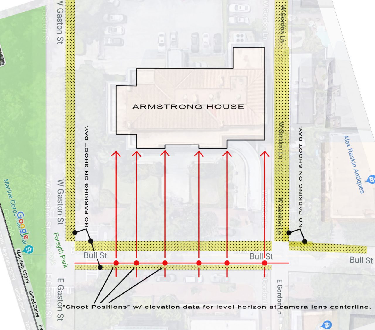
This image is a linear-panoramic mockup (a very rough mockup! This is a representative composition only.) In a linear-panoramic the camera position is moved, along a line parallel to the building face, to positions equal to building corners, window and door mullions, columns, etc. The images are then manually merged, blended, to each other, sequentially, producing a a view-point-composition similar to an architects’ “elevation” drawing. Essentially an impossible perspective from a person’s point-of-view.
This image-set of 10 shots was photographed handheld on August 10, 2019 by simply walking a somewhat parallel line to the building on Bull Street. The formal shoot will require the parallel “shoot line” to be laid out by a surveyor with elevation data for each corresponding junction point on the building such as building corners, window and door mullions, etc. The purpose of the elevation data is that the camera lens/sensor centerline must remain on a level horizon line for the entire length of the building.
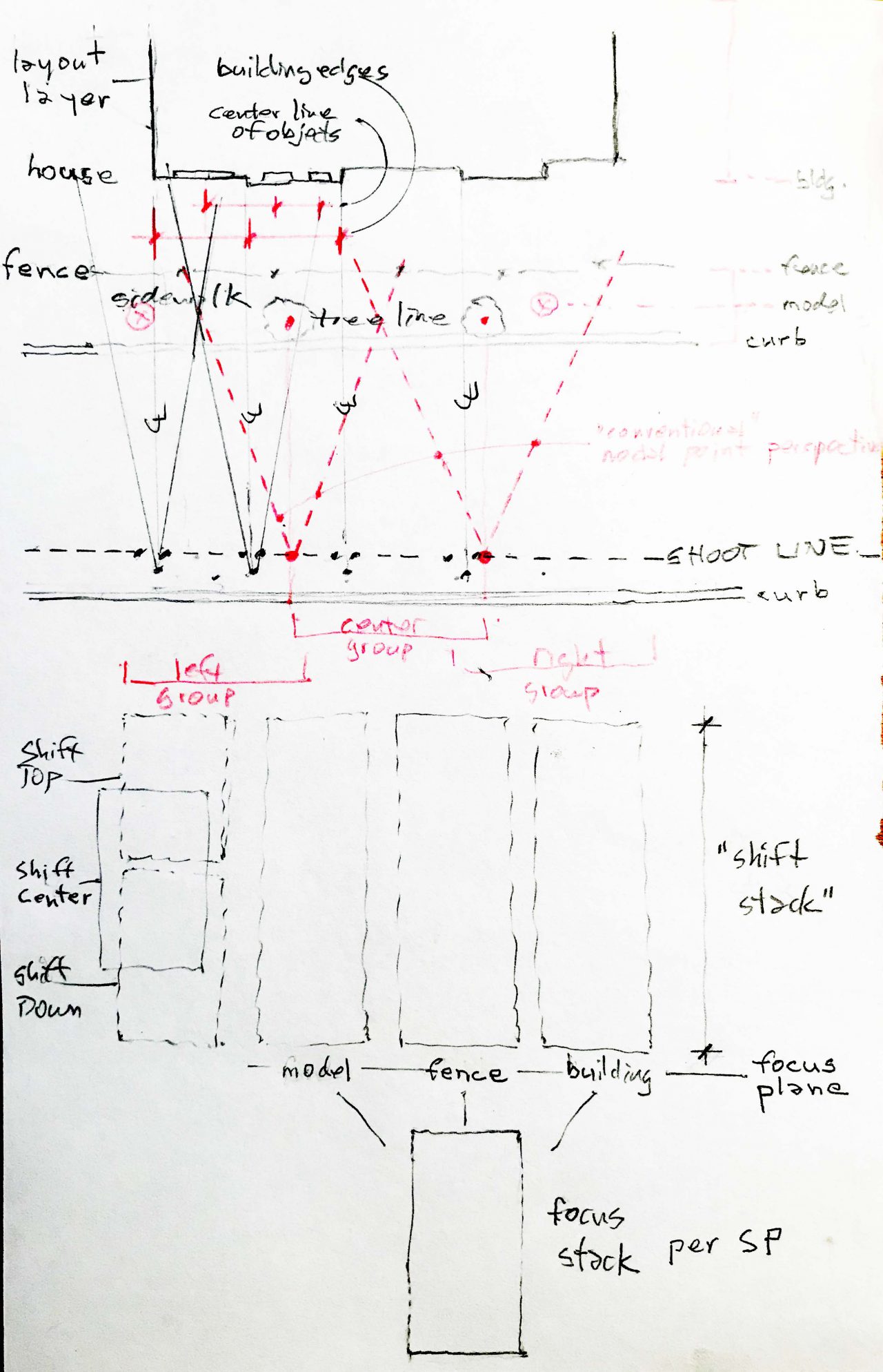
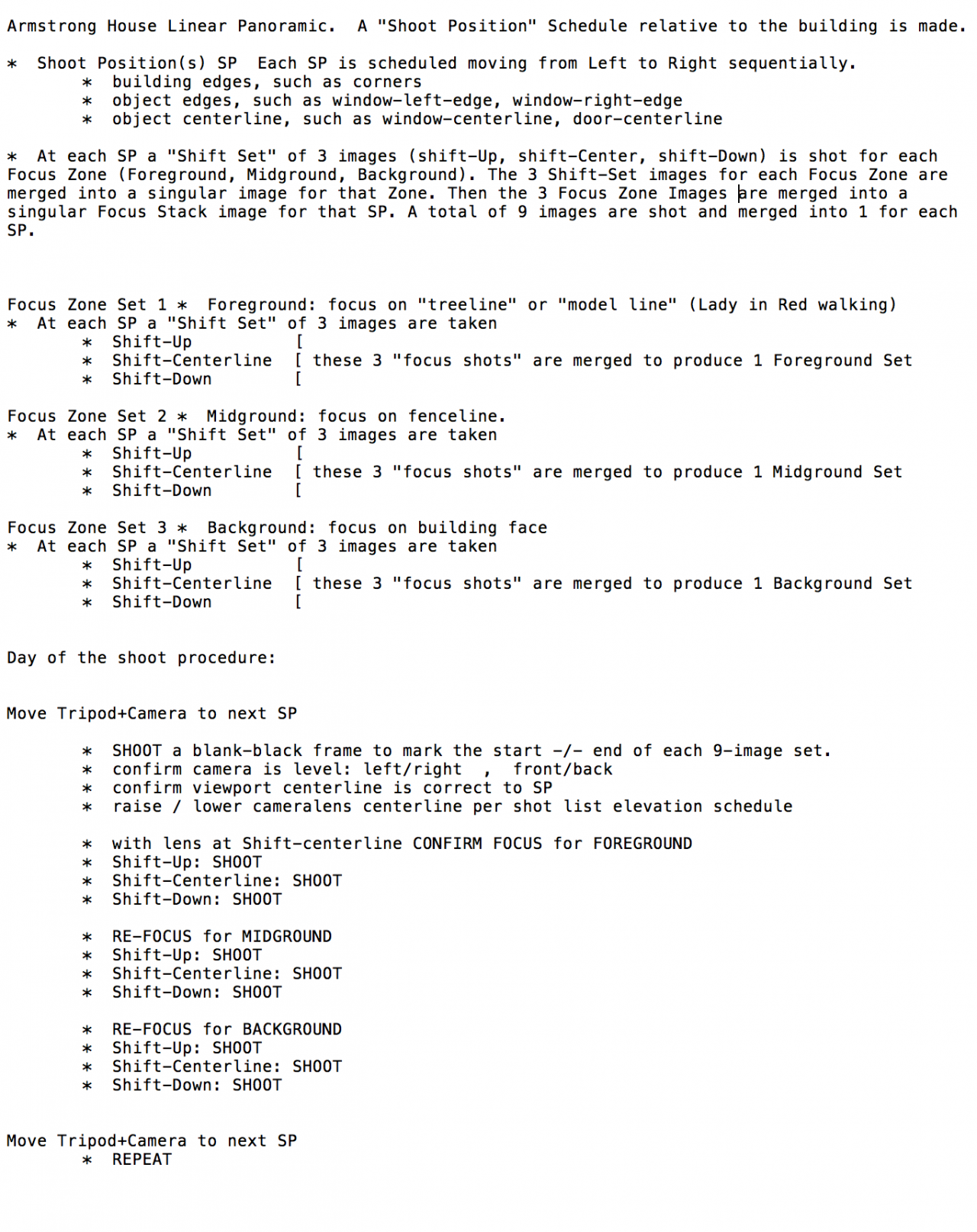
Two “focus planes” need to be shot: the foreground plane of the sidewalk-tree line, and the building face line. These focus-planes will be stitched and processed separately to avoid parallax errors in the overall panoramic stitch.
Additionally each “shoot position” will be photographed using a Tilt-Shift lens to increase the viewport height to include adequate sky and/or foreground (street and sidewalk). This mockup is composed of the “centerline” image position only. In the final, formal shoot, a Shift-Up, Centerline, and Shift-Down shot will be taken. Post-processing will first merge Top+Center+Down shots to comprise a “shoot-position-set”. These shift-position sets are then stitched, blended side to side, sequentially.


